Komentar resmi
Close the app fully and try it again. I actually just had the same issue and a restart of the app fixed it... We will look into that.
We do not offer loading of arbitrary DEMs yet.
Hi guys,
I am checking out the ability to download custom terrain tiles. I can see the custom dsm loading into the map so visually it works. However when I try to plot a course over the dsm I am getting internet connection errors everytime I try. wifi is connected to the phone and works for loading the other data into map pilot but for some reason it will not load the custom tiles for plotting.
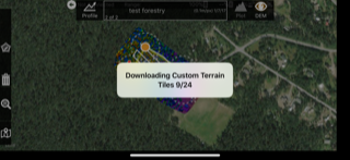
I get the white pop-up saying "Downloading Custom Terrain Tiles 0/286" for a few seconds followed by "Internet connection error Data service is required to download terrain data".
Maybe I have something set up wrong:(
On a side note, I have a very large area that I would like to load custom terrain into. I read somewhere that the custom tiles need to have been processed through MapsMadeEasy. Is there a way to upload the DTM into MapsMadeEasy to avoid needing to reprocess the entire thing. It is over 3000 20mp photos so I would rather not pay to get it processed. If this is the only option for the moment, fair enough, I will foot the bill to get it done but I would like to know that custom tiles work with terrain awareness before I go to the trouble of re-processing.
Thanks,
Matt
Close the app fully and try it again. I actually just had the same issue and a restart of the app fixed it... We will look into that.
We do not offer loading of arbitrary DEMs yet.
Harap masuk untuk memberikan komentar.
(Wringing my hands seeing the bold yet)
I've tried shutting the app down/restarting the device multiple times as well. I processed these sites through map pilot around a year ago, could this be the issue?
Also these were just test sites which are very small and shot at a very low gsd. Maybe the small area covered combined with the 0.1m/px is causing Map Pilot to throw these errors.
I have also tried this now on an Iphone 7 and an IphoneX. Could it be something as simple as getting a new terraain token for the account?
Around a year ago should be OK. If you have the capability to make volume measurements the tiles should be there.
Emails us with the specific map and we can give it a look.
The DEM gets resampled to 10cm/px GSD for volume measurement and those same tiles are what gets used for the custom terrain awareness.
The terrain token shouldn't matter. Let's make sure the tiles are there first...
Also, generate a new user token and email it to us so we can try it as you are seeing it. After we get back to you you can generate another one.
We tested with 'Wood Yard' which was made Aug. 26, 2015, 7:30 p.m.
We enabled the volume tool height map generation on February 15, 2016
https://support.dronesmadeeasy.com/hc/en-us/articles/206292003-Volumetrics-Tool
After trying the 'Test Forestry' job that was posted Jan. 8, 2017, 3:56 p.m.
It downloaded the tiles fine.


Please remember to issue yourself a new token.