
Bình luận chính thức

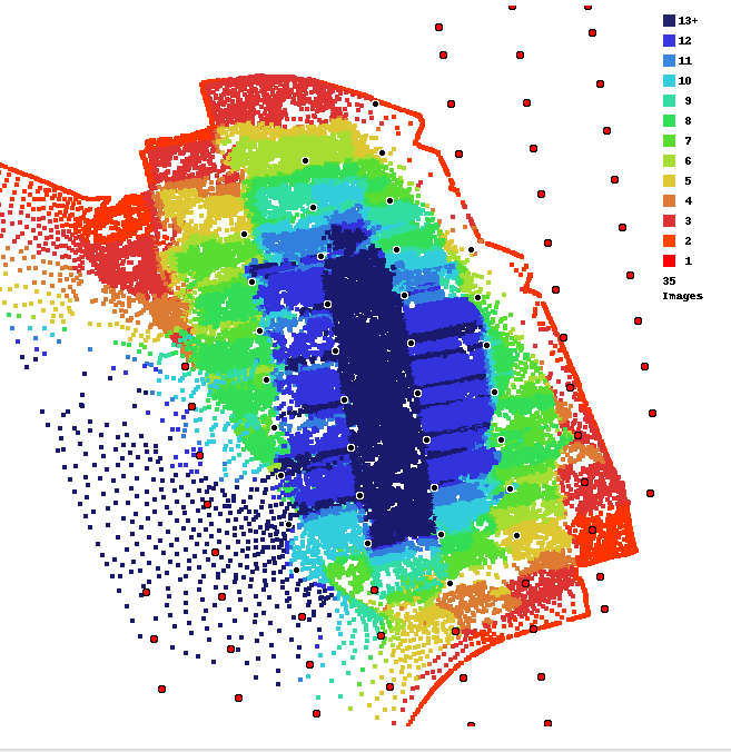
This area is basically solid trees. As noted in the Data Collection guidelines that are agreed to at the time of upload we require at least 80% overlap when trees are involved. 75% is insufficient.
From the Data Collection guidelines:
Use LOTS of Overlap in Treed or Crop Areas
Trees are hard to render because they are typically almost always in motion and have a lot of fine detail.
Generally, the orthophoto portion of the processing may turn out fine at 65-70% overlap. However, if there are trees included in survey area and you want the 3D components of the processing to turn out well, we recommend using 80-90% overlap in order to make sure we have enough information to represent the trees properly. Also, avoid windy days when trees are involved.
___________________
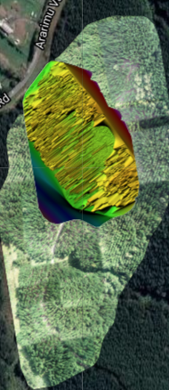
You can see that the Flat Map Failover feature filled in the area as best it could. The Flat Maps feature works best when low overlap (10-15%) is used when flying with Map Pilot Pro.
You can read about Flat Maps here:
https://support.dronesmadeeasy.com/hc/en-us/articles/360054461812-Flat-Maps