
Bình luận chính thức

It looks like your latest job was able to use 53 of the 99 images that were uploaded.
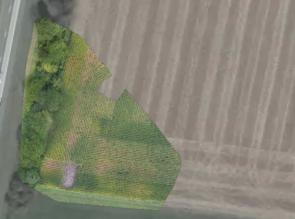

As is noted in the Map Pilot overlap settings and our Data Collection guidelines, very high overlap settings (>80%) are required for corn. The edges worked out because the trees were there to serve as anchors but the big open areas of corn require lots of overlap or the system won't be able to differentiate between the repeating patterns.
Also, unless it is totally dead winds, corn tends to almost always be in motion which makes it very hard to do well with out tons of overlap.
Thao tác bình luận