
공식 댓글

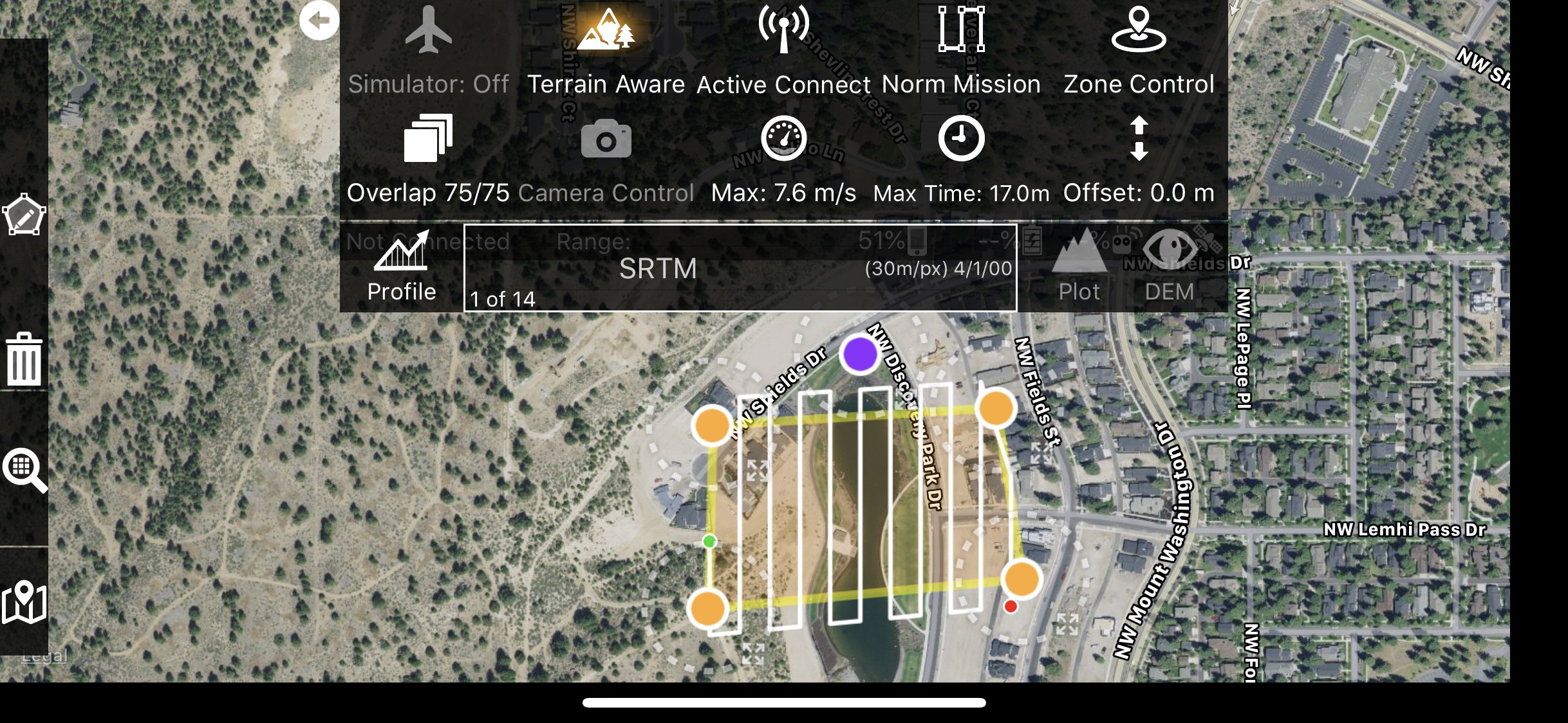
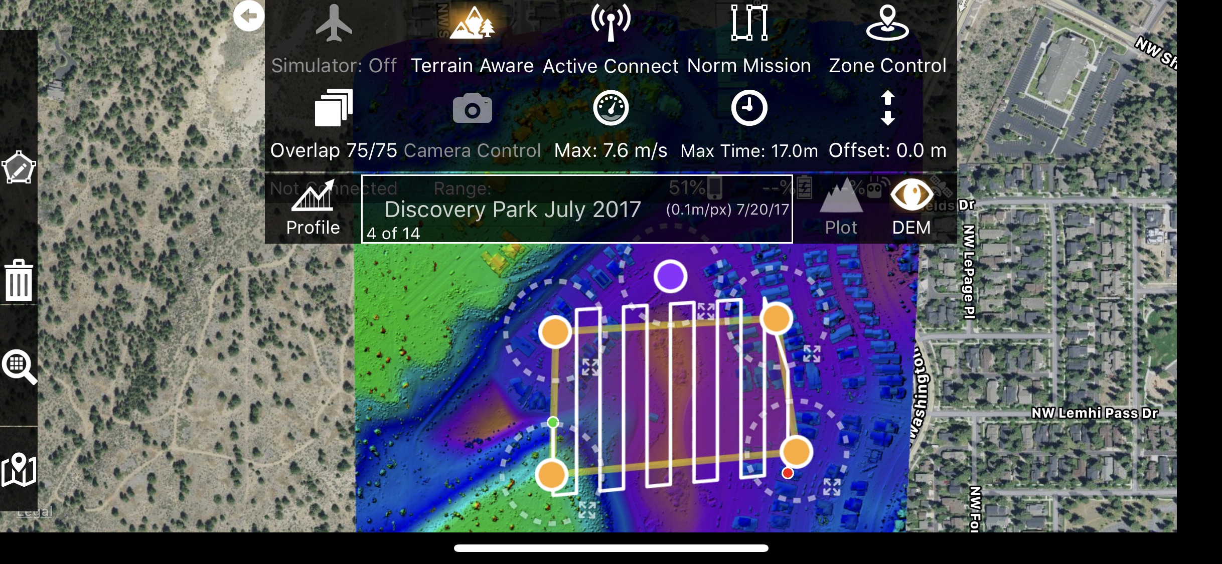
Currently, the only source for the custom DEM is Maps Made Easy data. So fly high over the area you want to fly, process it in Maps Made Easy and then you will have a detailed version of your modified earth DEM that can then be used as the Terrain Awareness data source for lower flight.
댓글 작업