공식 댓글

We are using the 1 Arc-Second Global data set. We also do a bilinear interpolation for more smoothing within the pixels.
댓글 작업

Hi,
First let me thank you for Map Pilot App, in my opinion is the best aerial photogrametry capture iOS app for DJI drones.
Would it be possible to know what exact source is currently being used by Map Pilot App to compute the "Terrain Aware" adaptive terrain flight path?
I'm asking because there are many public versions of the SRTM data (both 1 and 3 arc sec) out there and I want to check the differences between the SRTM model you use and very high resolution data sourced from a local agency.
I do believe that the SRTM data you are using, partially due to it's GSD partially due to XSAR capture method, smoothes the terrain elevation variations which would be very beneficial for a job I have in mind. :-)
Many thanks
Isaac
We are using the 1 Arc-Second Global data set. We also do a bilinear interpolation for more smoothing within the pixels.
댓글을 남기려면 로그인하세요.
Masterpiece.
Many thanks.
This is wonderful! see the SRTM 1 arcsecond (30m GSD approx) below:
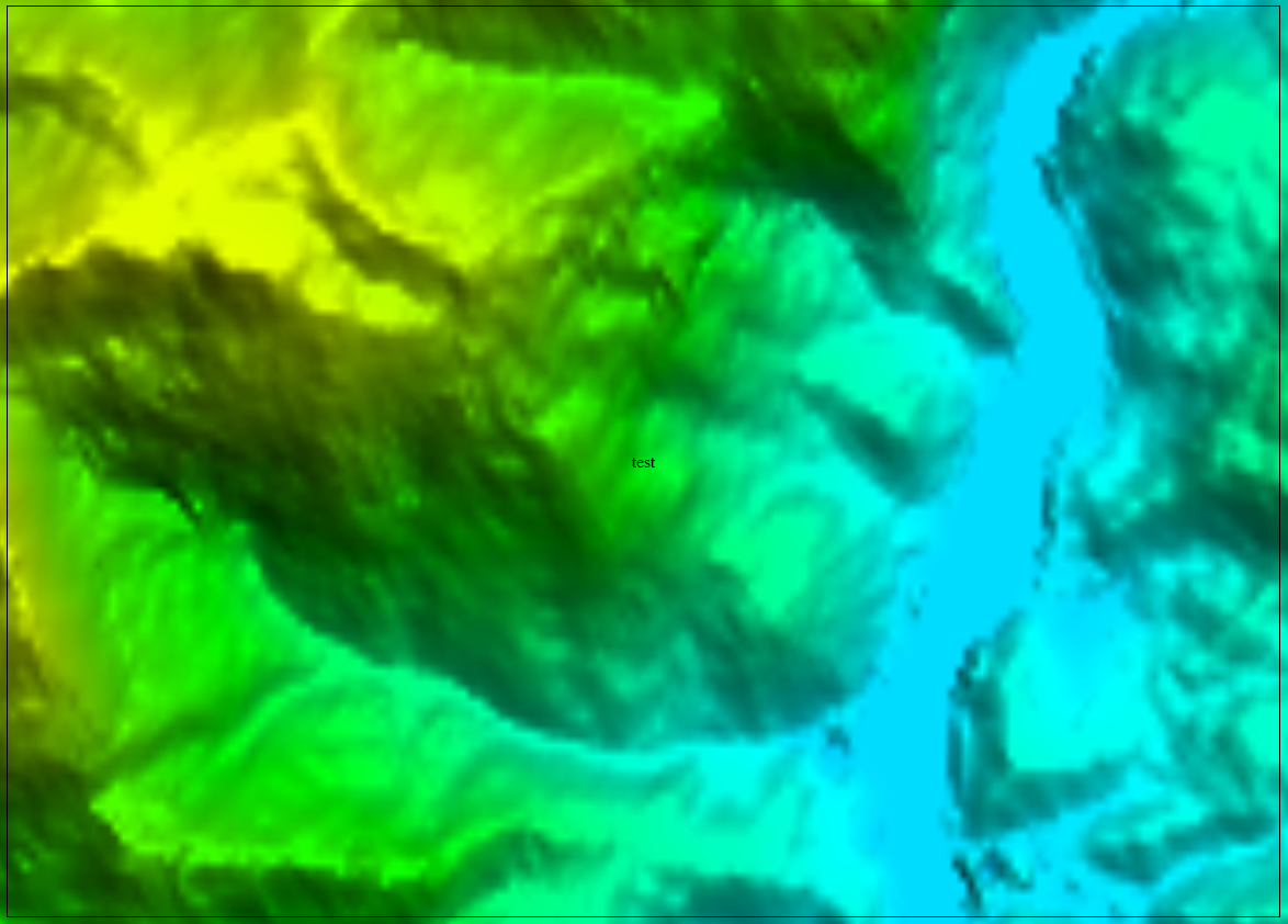
Compared to the 2 metres GSD DEM:
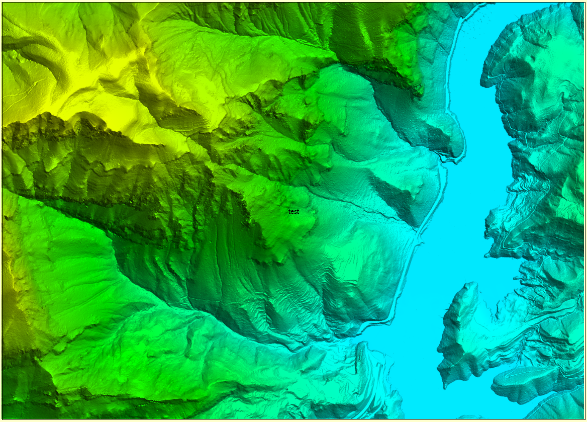
Most of the vertical cliffs (300 metres in some cases) and sharp valleys are gone (I have made DEM subtractions and crossections to confirm this).
This means smooth flights in the vertical domain. Excellent!
Cool! The terrain aware flight path is also simplified to use a reasonable amount of waypoints. The simplification keeps the altitude within 5% of the prescribed AGL height.
Hi again Zane, as you can see I'm kind of interested in mapping very rough terrain which made me think that I may run in to height limitation issues, let's say that the terrain rises 400 metres from the take off point and I want to do a "Terrain Aware" (terrain conforming) flight at 120m AGL, am I correct to say that the Mavic Pro would stop (return home?) when the ground under the drone reaches 380 metres over the takeoff point?
Would it be a good procedure to start the flight at the highest point of the terrain so that the whole survey has terrain elevations under the takeoff point?
Is there any limitation regarding how deep a Mavic may descend below the takeoff point when doing a "Terrain Aware" flight?
Many thanks
Please see the "Maximum Flight Height" section of the following article:
https://support.dronesmadeeasy.com/hc/en-us/articles/211810943-Terrain-Awareness
Starting at the highest, or at least a higher, point will buy you more elevation range since there doesn't seem to be a limit to how far below take off it will go. Not that we have heard of anyway...
Thanks Zane and sorry for the RTFM