Komentar resmi

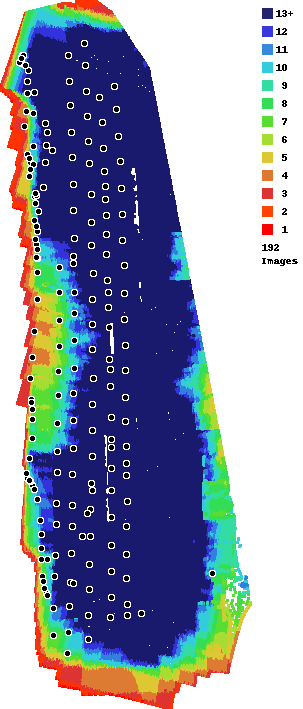
It appears that your model was rotated. If you look at the elevation layer you can see that it is tilted to one side. This was likely caused by the inconsistent speed at which the images were taken. In the overlap report you can see that there we some images that appear to have been taken under app control and then that whole line to the west was likely taken under free flight. This will throw off our computer camera calibration and cause some strange effects. This is the main reason why we attempt to take all images while traveling at the cruising speed.
Tindakan komentar