
आधिकारिक टिप्पणी

Neither Map Pilot Business nor Map Pilot Pro do anything that touches how the tags are written by the camera. We wish we could... The camera writes the tags and there is nothing anything SDK apps can do to change that process.
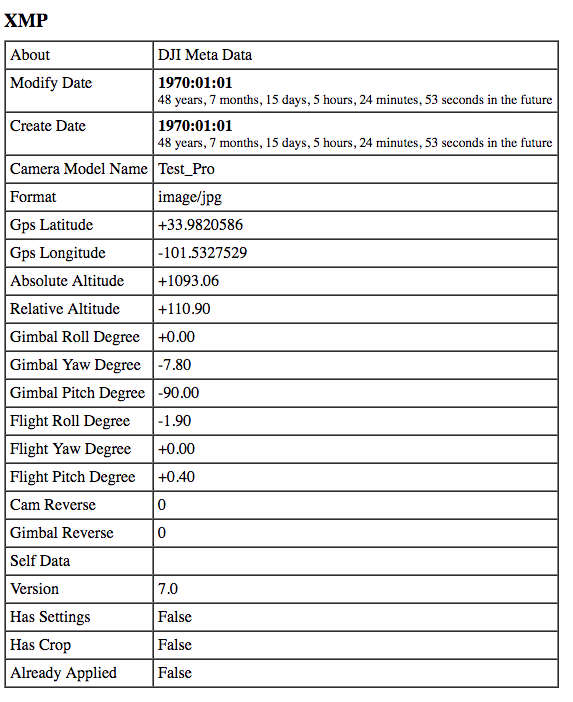
It is a bit hard to see but it looks like the images at the bottom there are pretty much straight down (nadir). On the aircraft this will be reported as being -90 degrees with 0 degrees being level with the aircraft.
Here is a sample of what is reported in the XMP data:
This is pretty much universal for all DJI tags and is what our Flat Maps system operates off of.
The pitch is not reported in the EXIF section of the tags as far as I know.
Whatever software that is must not like something but nothing is different in the tags between MPB and MPP. Feel free to send us a sample image to inspect but based on the images at the bottom there I am going to guess it says -90 or something close to it.

