
Not sure how that would work... That is not something we are planning.
टिप्पणी क्रियाएं

Are there plans to process both the RGB and NDVI together in one image in the near future? I uploaded both and only got the RGB. I'm fine uploading each separately, but I wondered if putting them in the same one would be possible.
कृपया टिप्पणी करने के लिए साइन इन करें करें.
Not sure how that would work... That is not something we are planning.
All good I guess it would be the case of separating the images. Once uploaded and then put in the same layer. In the end product.

As a follow up to this question, how do I process imagery from the M3M? When I try the Dji workflow it tells me the xmp and exif data is missing. Am I supposed to process in another workflow?
The M3M offers RGB imagery as well as a processed NDVI image and the individual bands right out of the camera.
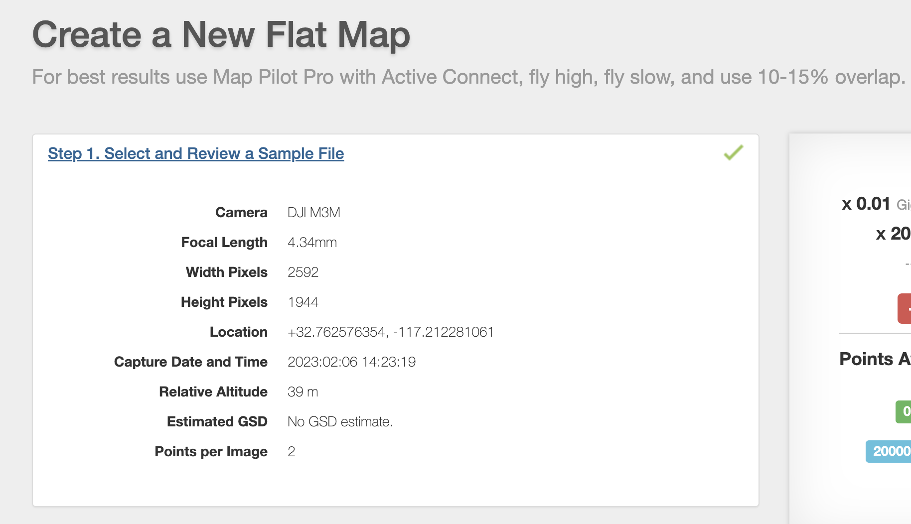
As long as you haven't modified the imagery yourself Maps Made Easy will accept the tags the way they come off the camera. You can process the NDVI images into a map on Maps Made Easy using the Flat Map option. Since a majority of the detail has been removed from the images at that point it is really the only way to get it into a map.
The good news about this is that you only need to use 15% overlap or so since you won't be using feature matching to create you map.