Commentaire officiel

We are aware of this in 5.4.0. It will be fixed in 5.4.1 which we anticipate will be released next week.
Actions pour les commentaires

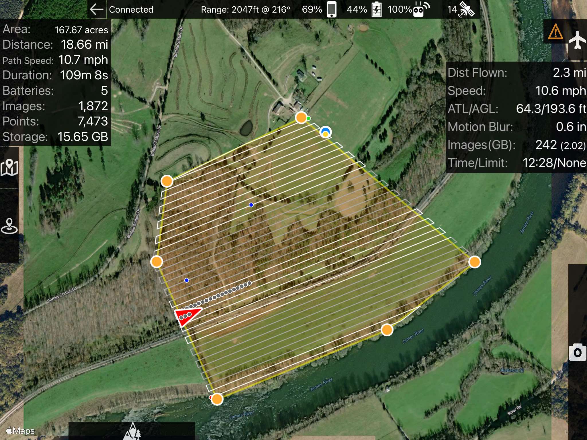
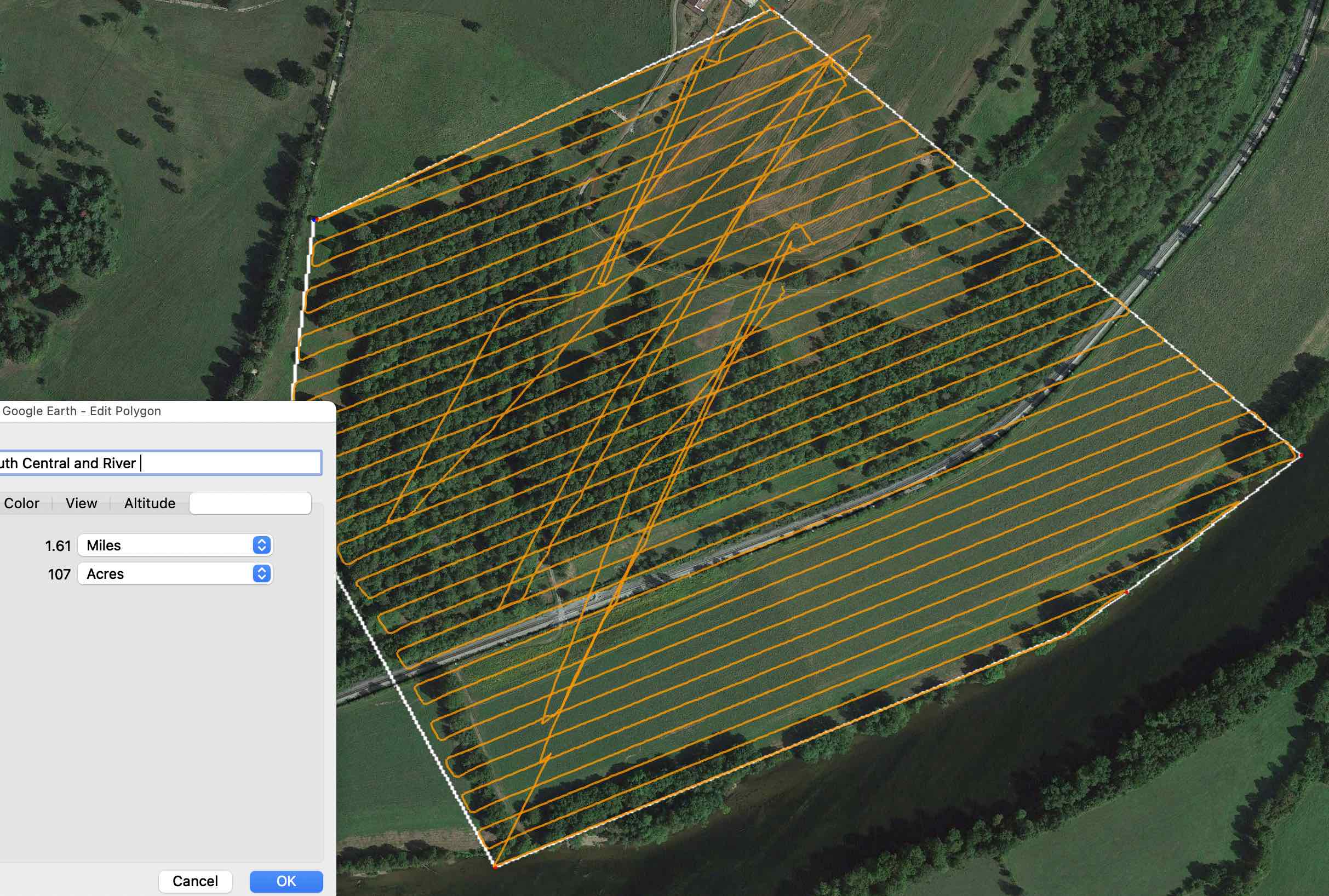
Hi, I noticed that the acreage displayed by MapPilot seemed high given my knowledge of the fields I was mapping. Taking the kmls from the mission flights into Google Earth or QGIS gives an area of 107 acres, whereas Map Pilot displayed 167 acres. Here are screenshots:
Calculated in Google Earth
We are aware of this in 5.4.0. It will be fixed in 5.4.1 which we anticipate will be released next week.
Vous devez vous connecter pour laisser un commentaire.