
Official comment

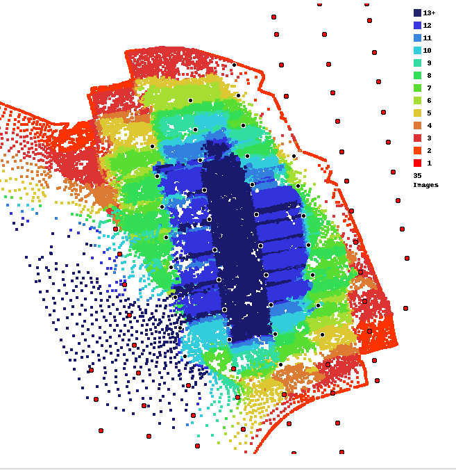
This area is basically solid trees. As noted in the Data Collection guidelines that are agreed to at the time of upload we require at least 80% overlap when trees are involved. 75% is insufficient.
From the Data Collection guidelines:
Use LOTS of Overlap in Treed or Crop Areas
Trees are hard to render because they are typically almost always in motion and have a lot of fine detail.
Generally, the orthophoto portion of the processing may turn out fine at 65-70% overlap. However, if there are trees included in survey area and you want the 3D components of the processing to turn out well, we recommend using 80-90% overlap in order to make sure we have enough information to represent the trees properly. Also, avoid windy days when trees are involved.
___________________
You can see that the Flat Map Failover feature filled in the area as best it could. The Flat Maps feature works best when low overlap (10-15%) is used when flying with Map Pilot Pro.
You can read about Flat Maps here:
https://support.dronesmadeeasy.com/hc/en-us/articles/360054461812-Flat-Maps