
We can only respond to support requests that are made in English.
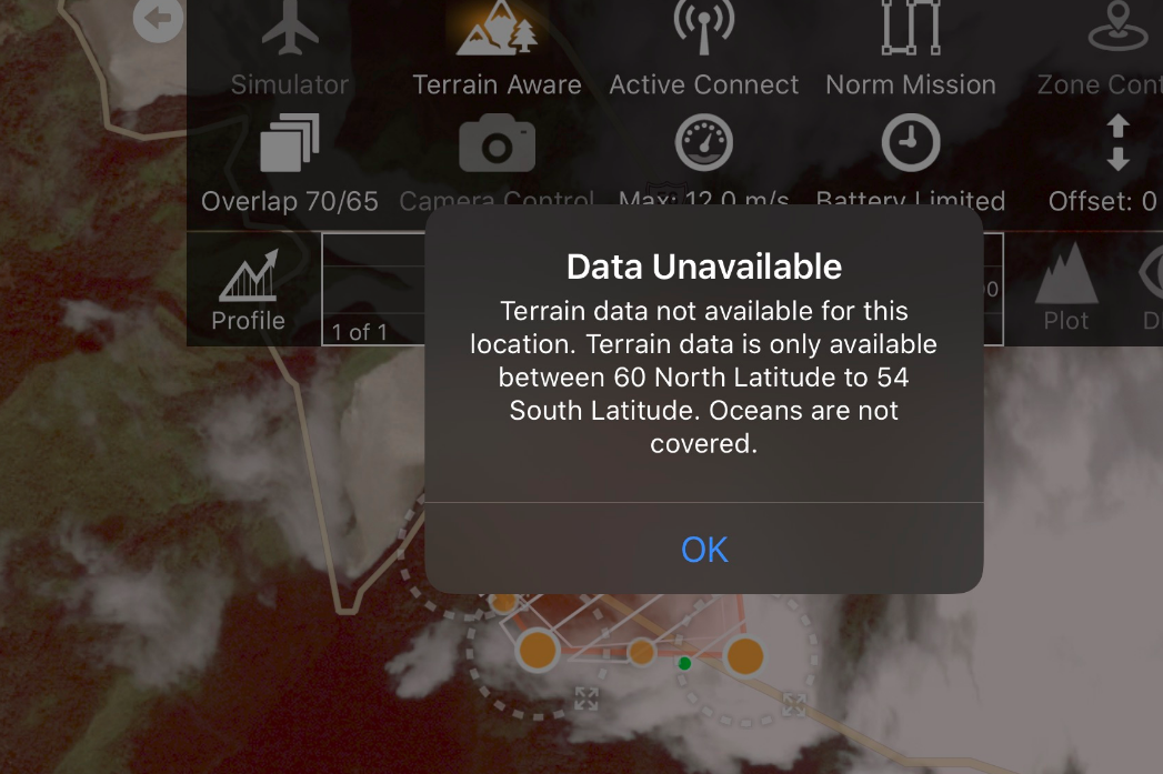
If your latitude is outside 60N to 54S terrain awareness won't work without supplying it with custom data.
Comment actions

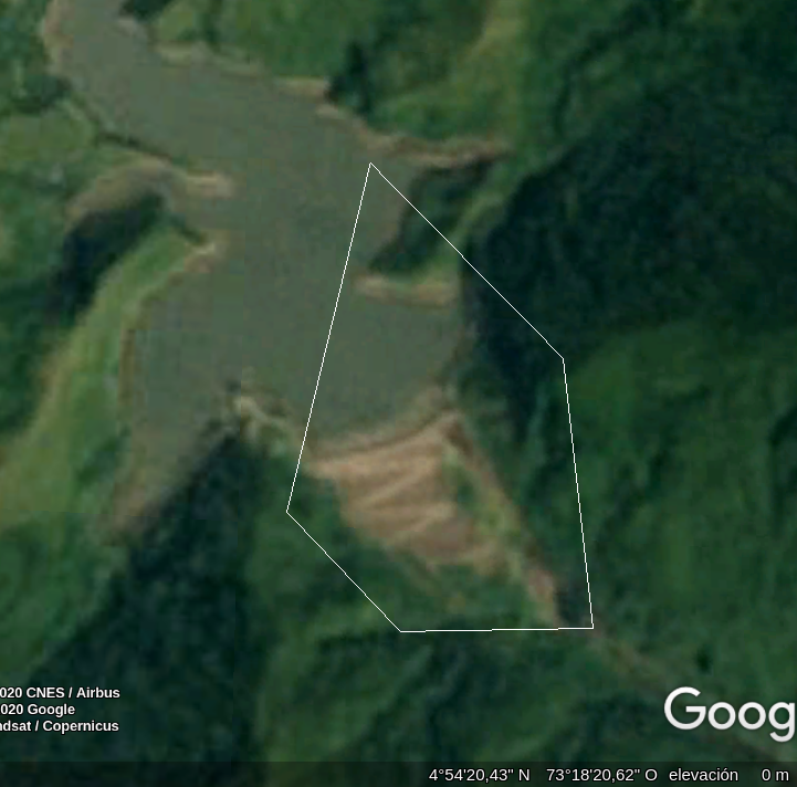
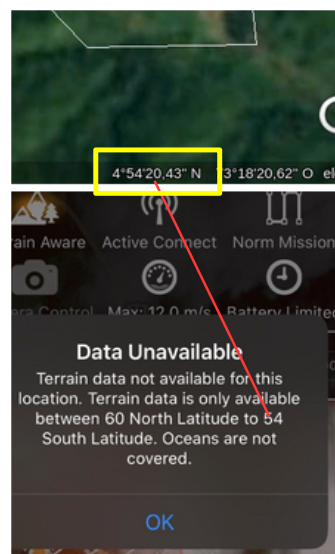
Como podría solucionar el error que aparece en las dos figuras de abajo? sabiendo que el lugar de trabajo está en el rango de latitud?
Mil gracias
Please sign in to leave a comment.
We can only respond to support requests that are made in English.
If your latitude is outside 60N to 54S terrain awareness won't work without supplying it with custom data.
Good night,
They say that an image says more than a thousand words,
 in the figure that had previously been attached and
that is currently highlighted it can be seen that the
work area is within the latitude range that the program
supports.
How could the problem be solved?
Thank youAs noted in the Terrain Awareness article, the SRTM data does have holes in it in certain locations. If you encounter one of these locations within the covered zone you might be able to rotate or move the mission a bit to get it to miss the holes. Flying a bit higher will help to reduce the number of waypoints which will reduce the likelihood of an intersection with one of these missing areas.
From Terrain Awareness:
"Missing Data - 99.9999999% of the supported area is well covered. The data is MOSTLY fine. There are areas where the where the radar was unable to get a reading that have "voids". These empty data locations are in areas where the data has not been fully processed by NASA and are generally in areas of deep ground features or glaciers. In the presence of a "void", Map Pilot will use the last known good elevation. This is the safest course of action since these voids usually occur in deep places the aircraft shouldn't be going to anyway. The voids are usually small and Map Pilot attempts to overestimate the altitude."
If this continues to be an issue and the area must be covered you can provide your own terrain data using these tools:
Custom Terrain Source for Terrain Awareness
Arbitrary DEM Preparation for use as a Custom Terrain Source