Official comment

I am not seeing any issues with your most recent maps. Can you please post a screenshot of what you are seeing?
Comment actions

I am having trouble with my processed maps having an incorrect rotation from real world conditions. Is there something I can do to correct this or calibrate my equipment to prevent it in the future.
I am not seeing any issues with your most recent maps. Can you please post a screenshot of what you are seeing?
Please sign in to leave a comment.
This is what I'm getting. You can see from the road that it is not aligning with where it should be at the southern/eastern portion of the site. I have not been manually referencing the surveys, so this may be part of the problem. I shared another map with a civil engineer colleague I work with and he noticed the same thing on that one. Any advice?
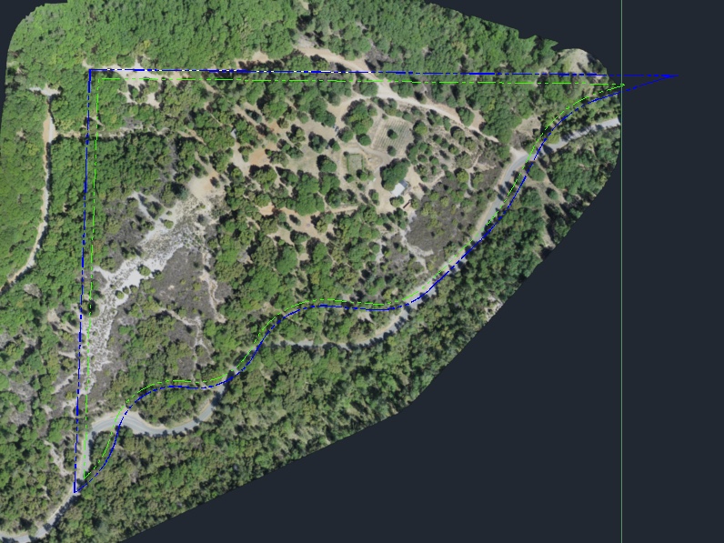
Ahh. I though you meant some huge rotation. Small rotations like this are caused by inaccuracies in the GPS data. Consumer GPS is generally viewed as being with 10 meters. To get it nailed down more you need to manually georeference it using GCPs. You can use our manual rereferencing workflow:
https://support.dronesmadeeasy.com/hc/en-us/articles/360000518146-Manual-Rereferencing
You do not need surveyed GCPs to do this. You can do it by right clicking on the basemap layer to get the coordinates and then adjust the markers in the rereferencing screen to those exact locations.