
Official comment

The Terrain Awareness panel shows at the bottom now and the mountain icon is what you press to calculate the profile.
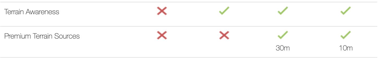
With 5.5.0 we have added dynamically available terrain data sources. Previously it was just SRTM and your own custom data. Now we have added global coverage for Copernicus and ASTER datasets as well as other higher resolution options for certain regions.
You can read more about this here:
https://support.dronesmadeeasy.com/hc/en-us/articles/14697118095380-Built-in-Terrain-Data-Sources
Comment actions
