
Offizieller Kommentar

If you are working with the actual DEM file itself you would just want to use a QGIS tool to do it. Do that like this:
https://docs.qgis.org/2.14/en/docs/training_manual/rasters/terrain_analysis.html
The way to do it in the browser would be do draw a line of a known length.
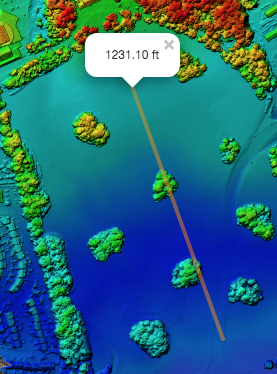
Then get the elevation of the two endpoints.
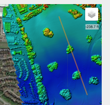
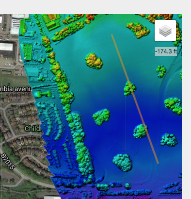
Elev Diff = -174.3 - -238.7 = 64.4 ft (bad example because this map had negative elevation values due to not using a ground reference image)
Slope = Rise/Run = 64.4 / 1231.1 = .0523 slope = 5.2% grade
Aktionen für Kommentare