
Offizieller Kommentar

1. There are no area limits on the Free service level.
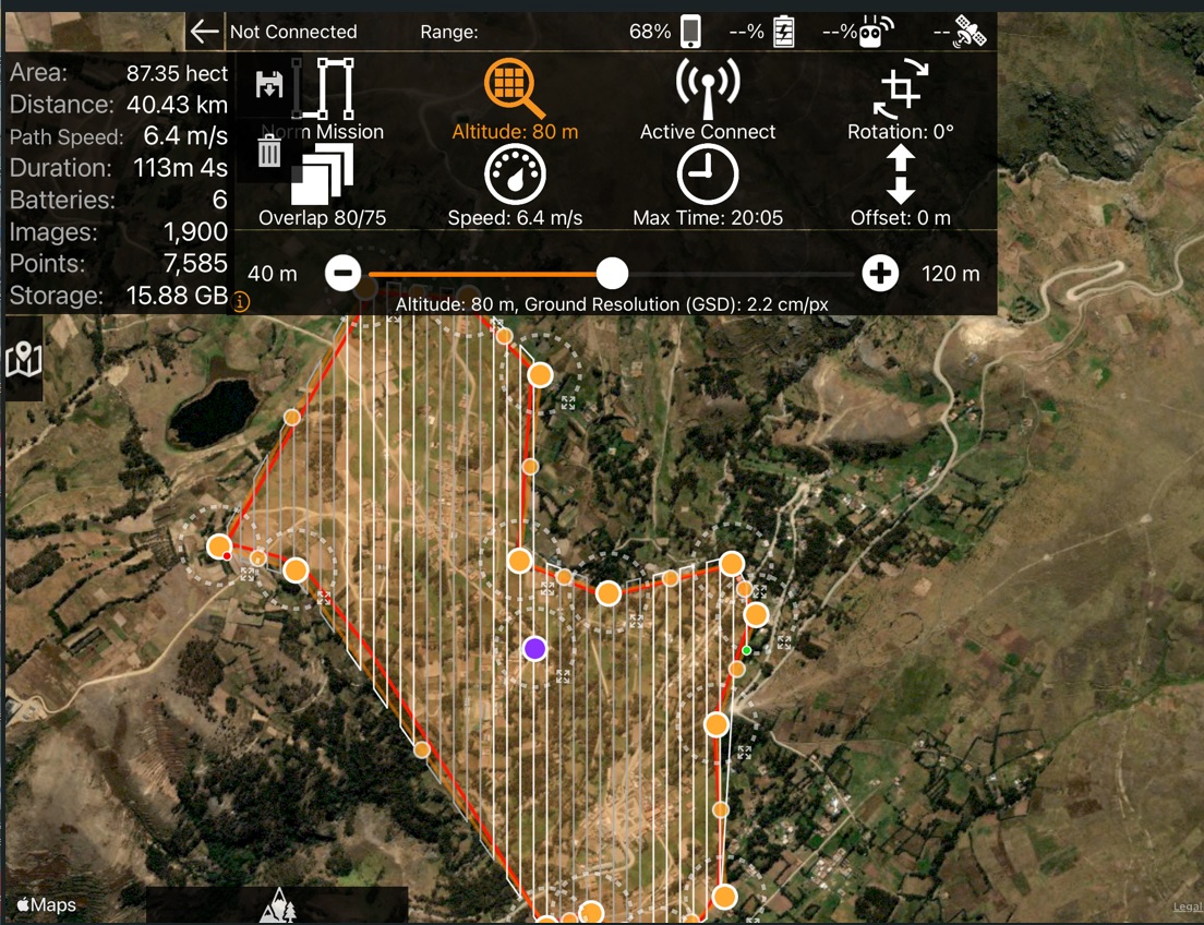
2. "Points" refers to how many Maps Made Easy points it would take to process the 1900 images it is estimating it will take to cover that area. A waypoint is a place where the aircraft flies too. Basically it is very corner.
3. You really want to do all the imaging in as short a time as is possible. If you take a bunch of hours off in the middle the lighting will change and the features won't match as well when it comes time to process the data.
4. If you can do it at the same time of day and it is equally sunny on both days it could work but it isn't recommended.
The options for covering more area in a single battery:
- Fly higher
- Use less overlap
- Fly faster
You could probably do it OK with 2 but 3 seems to be the minimum people use for continuous flying.