تعليق رسمي

We are aware of this in 5.4.0. It will be fixed in 5.4.1 which we anticipate will be released next week.
إجراءات التعليق

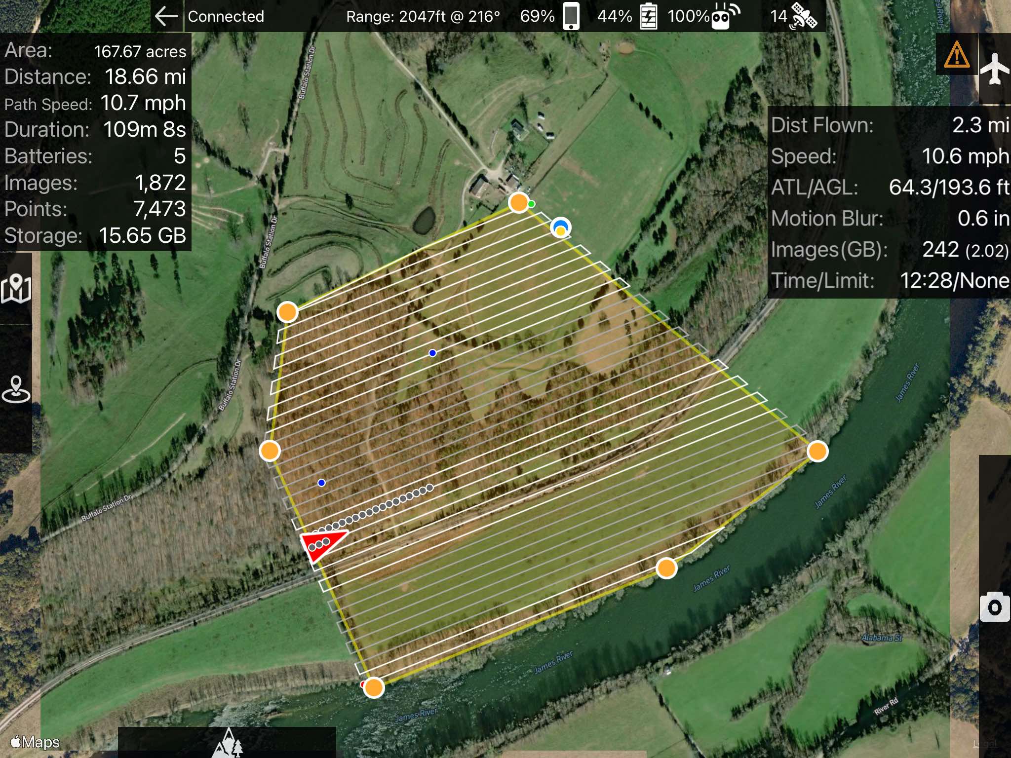
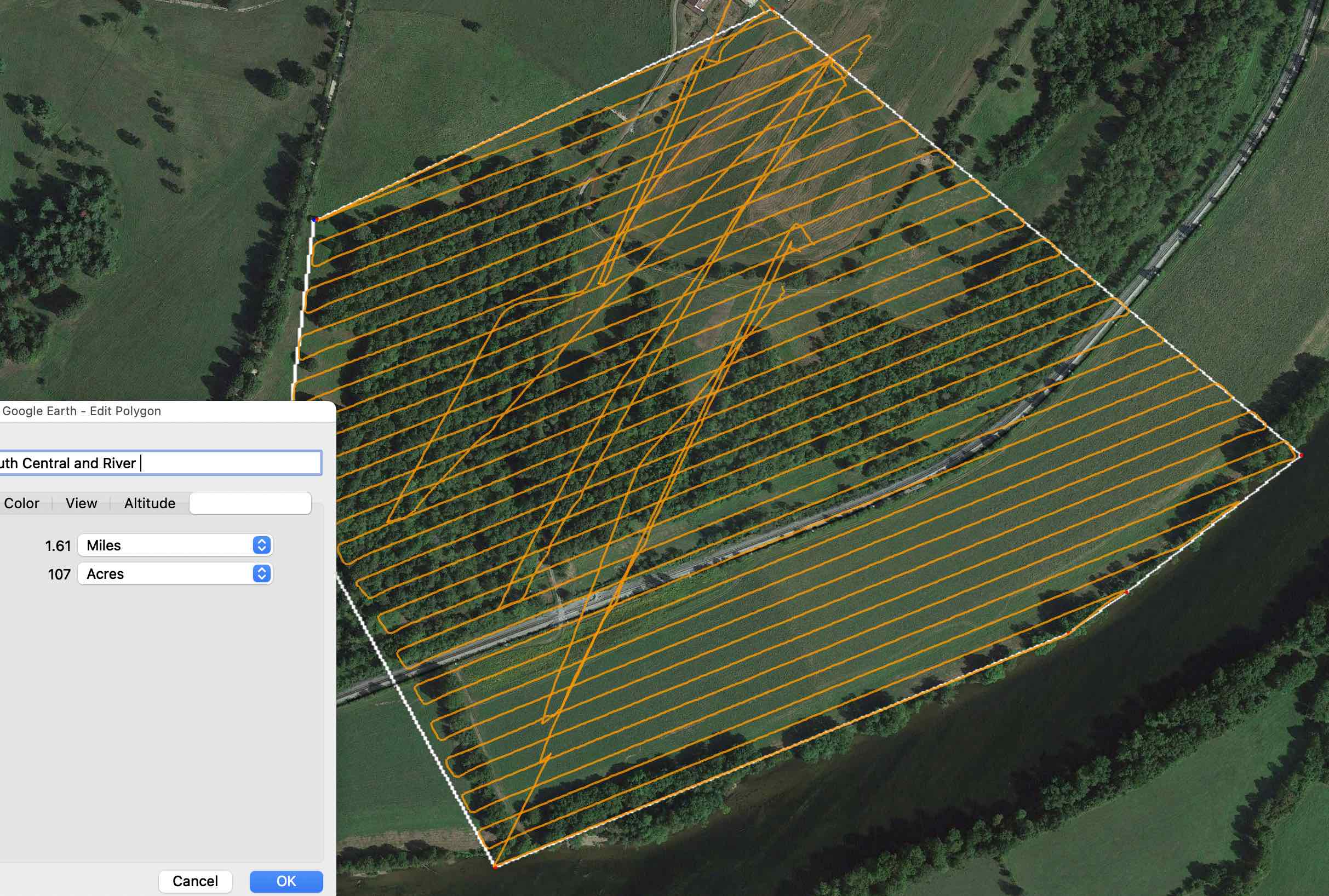
Hi, I noticed that the acreage displayed by MapPilot seemed high given my knowledge of the fields I was mapping. Taking the kmls from the mission flights into Google Earth or QGIS gives an area of 107 acres, whereas Map Pilot displayed 167 acres. Here are screenshots:
Calculated in Google Earth
We are aware of this in 5.4.0. It will be fixed in 5.4.1 which we anticipate will be released next week.
الرجاء تسجيل الدخول لترك تعليق.