
تعليق رسمي

We are sorry you are not happy with your results. Your overlap was good in general but when mapping areas that have tall stuff like power lines like that you want to fly a bit higher.
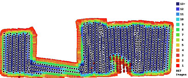
You uploaded 910 images to process and 867 of them were included in the output so 43 images were not able to be included in the outputs.
It looks like the trouble area had 6-8 tall and pretty complicated power line towers it in. That combined with the low flight and long shadows made for too many mismatched features.
Also, at this time of year when shadows are moving pretty quickly. The motion of the shadows between passes turns into a big problem for our system that relies on static features.
This job MAY have turned out if it was cloudy and if you were flying higher.
We are sorry, but there is no way to add the images back in after the fact.