
تعليق رسمي

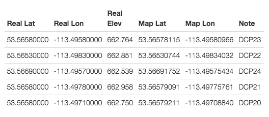
All of your 5 surveyed points have elevations within .4 meters which is probably not true... So that is one source of error.
What kind of GPS are you using? What is it's vertical accuracy?
The initial model had some curvature to it since you included the images at the ends of your passes. Map Pilot does not do this and gets less curvature in the initial model. The less there is initially to correct for, the better.
The biggest issue here though is the fact that you don't have very many GCPs and the ones you do have aren't spread out around the whole area very well.
The referencing process takes the GCPs and their errors and tries to correct for it with a polynomial offset (not a linear one). This is an attempt to take out curvature in the DEM.
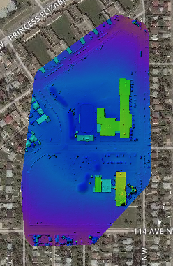
For reference, here is your original:
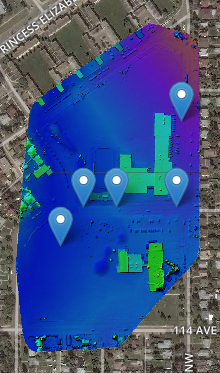
Here is the referenced version: