منشور

‏2 متابعين اتباع
0
Avatar

How to fix doming

Hi Team, you have noted in the below map that adding a corner to the map likely led to elevation distortion. 
I need to pull contour lines out of this map so the elevation distortion is quite a big problem. Should I just run the maps again separately and then combine the contour lines or would you suggest another approach?

https://www.mapsmadeeasy.com/maps/public/894037bf326546108ae7f1bfa80d658c 

Jackson White

تعليق رسمي

Avatar

As noted in your Reviewer Notes: 

"Having that little section tacked on in the northeast corner is risky and heavily contributed to the elevations being distorted. The overlap on the collection doesn't look great either."

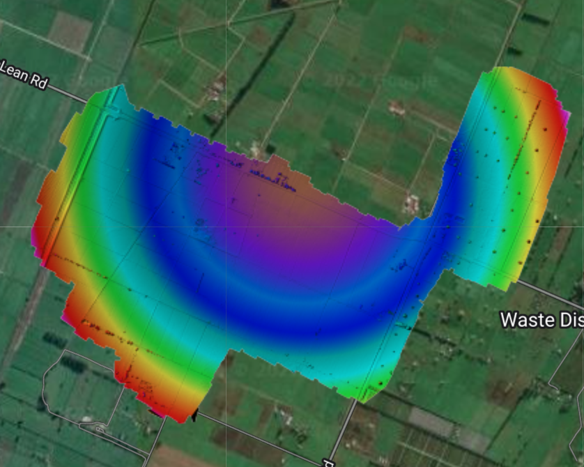
Irregularly shaped survey areas will cause issues. Square is best. Rectangles are OK, just not super long aspect ratio. Things with weird appendages are going to be bad. 

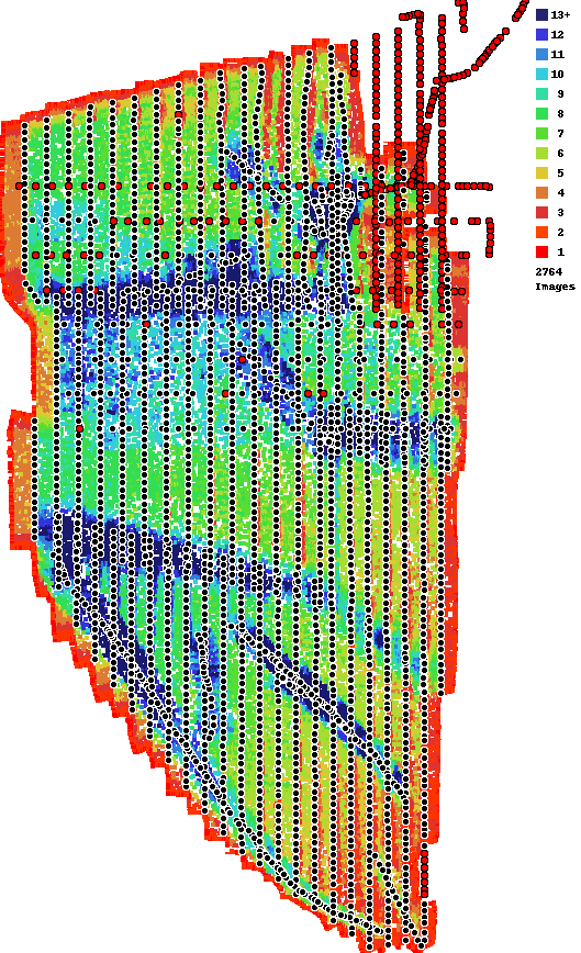
Running the images taken after 0227.jpg separately would help both.

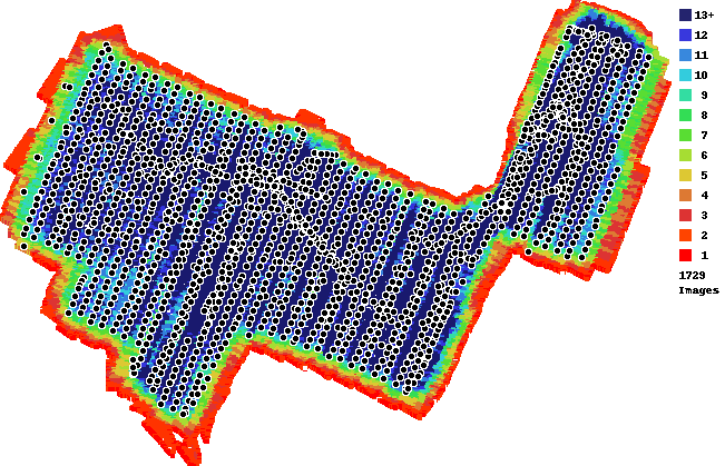
The overlap here is pretty goofy and irregular. The images are taken at all different speeds and spacings. This isn't helpful. 

Based on your flight logs it looks like there were some significant winds that you were getting warnings for. This isn't really a safe time to operate. 


Zane
إجراءات التعليق ارتباط ثابت

الرجاء تسجيل الدخول لترك تعليق.

7 تعليقات

0
Avatar

Ok I understand that, I will run them separately. Unfortunately as this is the shape of the land we had access to and I don't want to image over other land owners too much this is what we got but I will rerun separately. 
Yep you're right the wind was super high but it was the only day I had to take this map so it was what I had to deal with, unfortunately winds are consistently high at most of our sites. 

Jackson White 0 أصوات
إجراءات التعليق ارتباط ثابت
0
Avatar

Orienting the flight into the wind as opposed to across it is preferred. And turn the flight speed down a bit so the aircraft doesn't get overloaded flying into the wind. 

Zane 0 أصوات
إجراءات التعليق ارتباط ثابت
0
Avatar

Bugger, running them seperately didn't fix the doming. Are there any other ways I could fix these maps? (Also referencing my grampians one) I have run both of these sites at a lower overlap before and they have worked. 
I am really after a topo from both of them so the doming is really messing with things.

Jackson White 0 أصوات
إجراءات التعليق ارتباط ثابت
0
Avatar

Your overlap is sort of crazy on this. In addition to the weird wind affected passes there is another set over that. Take those images out. Just use regular overlapping images. You don't need all this other stuff in there. 

Your Grampians job also has all sorts of weird stuff going on with it. I don't know why that is in there but take it all out. This map had way less overlap but it also has a lot of weird cross stuff that isn't needed or recommended anywhere. Start with 75/75 overlap and adjust from there. Don't do all this extra stuff. 

Also, that dataset spans multiple days which is really hard to do. It gets even worse when you collect the top portion with vertical passes and then move down. That makes it so there is a ton of time between looks at it and the features will look different depending on the lighting. 

If you are going top to bottom to cover an area do horizontal passes and work your way down. 

Zane 0 أصوات
إجراءات التعليق ارتباط ثابت
0
Avatar

There are still quite a few areas with weird overlap taken at different times. As noted previously, 70/70 overlap is enough to get a map output but it isn't enough to get a good elevation result. You need 80/80 overlap for that without all the extracurricular stuff in there. There isn't much you can do to save this dataset beyond what you have already tried. 

Zane 0 أصوات
إجراءات التعليق ارتباط ثابت