
Bình luận chính thức

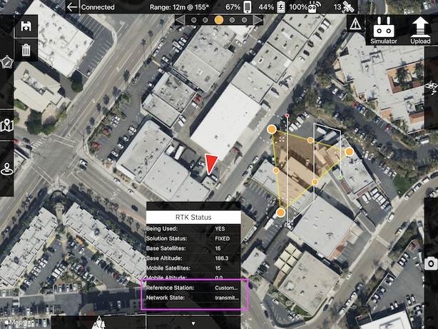
It is possible to connect to an NTRIP network in Map Pilot Pro if that is what you are talking about. It is handled in the RTK panel that shows up when you connect to the proper hardware.
Thao tác bình luận