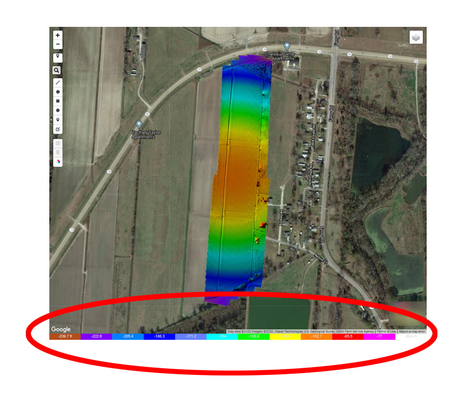

Curvature of the map aside (which we have discussed via email), the negative numbers are due to your mapping very near sea level and relying on the GPS derived altitude values in the EXIF tags. If you were to provide a ground reference image at the time of upload the altitude of the images would be adjusted to reference the elevation of the takeoff position instead of relying on the GPS derived numbers for altitude which can be 100s of meters off.
https://support.dronesmadeeasy.com/hc/en-us/articles/206208583-Ground-Reference-Images
Ações de comentário