
Comentário oficial

We are sorry to hear you are not happy with your results. It looks like you have something going on with your data collection. Part of it was collected as a Full Grid and the rest was not.
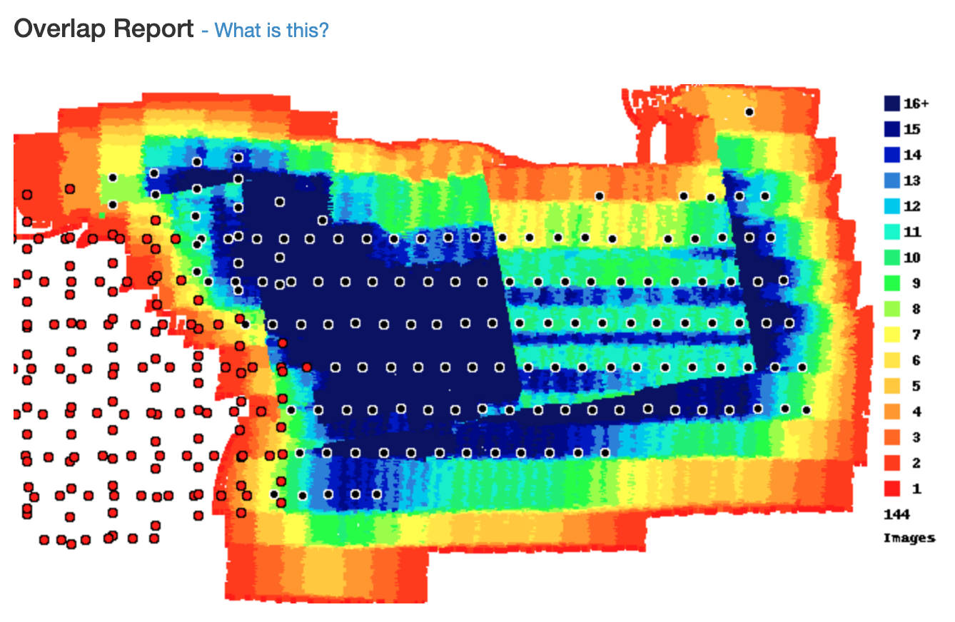
The bigger issue is that you are flying really low to the roof you are trying to map. It looks like your images were taken maybe 2-3 times higher than the roof. If the roof is your target you need to fly higher so you are getting the overlap you intended up on the roof, not at the ground level. Map Pilot Pro offers the Ground Offset feature to help with this. You would need to do something similar to ensure that the overlap you are getting is for the plane you are interested in mapping.
Roof tops are actually pretty hard to do well because of the reflective surfaces and the increased height.
Overlap is important but might turn out better if the cross passes were removed from the dataset.
Also, the next time you are out mapping try to include a bit more area around the edges of the buildings to provide some margin between the ground level images and the rooftop images. Jumping straight to the rooftop with the vertical edges right at the edges of the data can confuse things.