게시물

팔로워 4명 팔로우
0
Avatar

Output from Map Pilot test flight

Just wanted to share the results from flight using Map Pilot 1.1.4 and DJI firmware 1.4.0010.

https://www.mapsmadeeasy.com/maps/public/75092f29219c45b3a0f51639c591d854

Will try another flight with higher image density.

Kurt Bantle

공식 댓글

Avatar

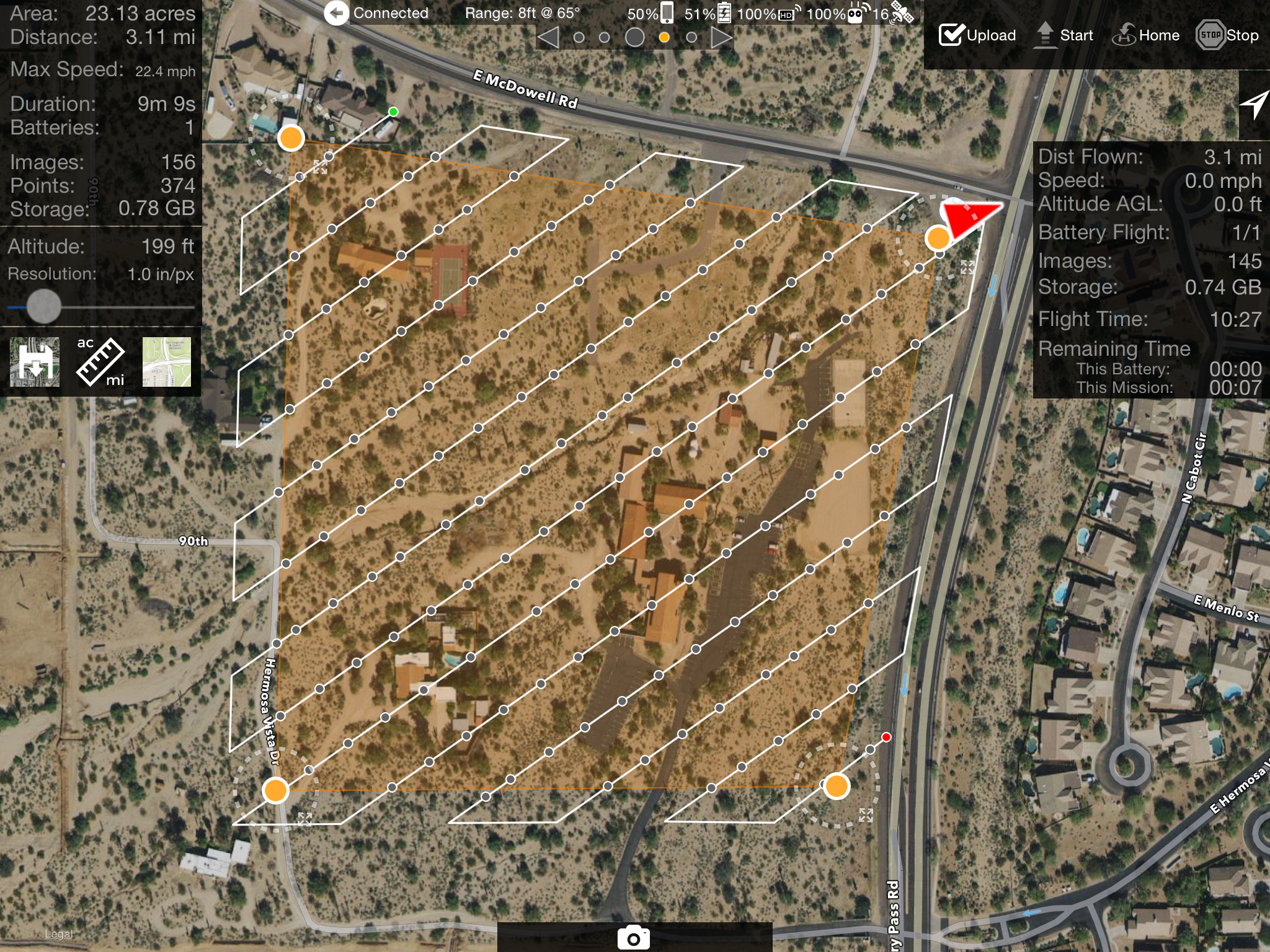
That is one of the best elevation maps we have seen! Nice work. Taking off near the high point of the terrain to be covered is the key here. Take off near the top and set the overlap down to 60% or so because you will have plenty as the terrain falls away.

Tudor
댓글 작업 고유 링크

댓글을 남기려면 로그인하세요.

댓글 9개

0
Avatar

Thanks Tudor. I will change the overlap, I was at 70%. I was going to try a lower altitude as well. You guys get the credit, all I did was upload photos. You flew the mission :-)

Kurt Bantle 0 표
댓글 작업 고유 링크
0
Avatar

Hi Robert,

Very nicely done. What was your altitude? Are you a beta tester? I'm dying to get my hands on map pilot for the P3P.
ps- I'm in Arizona also.

Luis Martinez 0 표
댓글 작업 고유 링크
0
Avatar

On Robert's map I really like the cactus shadowing. Very cool.

Luis, sorry, I didn't see your question, yes I'm a beta tester. Altitude was 60m.

Kurt Bantle 0 표
댓글 작업 고유 링크
0
Avatar

Soon Luis... Very soon. A new beta round is opening up tomorrow with the new release.

Tudor 0 표
댓글 작업 고유 링크