पोस्ट

2 अनुसरणकर्ता अनुसरण करें
0
Avatar

Question on how to read a map

Hi There


Can someone tell me how to read info on maps, is there any videos about?


For example see the below screenshot from one of my recently mapped areas, what are the numbers across the bottom? are they height above sea level? Because I’m a little confused, we took off near the blue dot in the middle which is basically the lowest point of the mapped area and towards the blue area is about 30/40ft higher than where the blue dot is but none of the figures at the bottom make any sense?

Dean

आधिकारिक टिप्पणी

Avatar

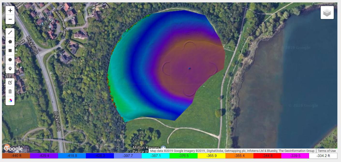
Those values are feet above sea level. You didn't include a Ground Reference image with your data set so Map Pilot was unable to correct the values that the GPS provides. You can read more about using a Ground Reference image here:

https://support.dronesmadeeasy.com/hc/en-us/articles/206208583-Ground-Reference-Images


Zane
टिप्पणी क्रियाएं Permalink

कृपया टिप्पणी करने के लिए साइन इन करें करें.

1 टिप्पणी