
आधिकारिक टिप्पणी

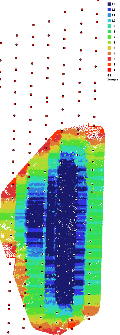
As noted in both our Data Collection guidelines and in Map Pilot, we highly recommend using at least 80% overlap when dealing with trees. It appears that you used 70% or less here as can be determined by the areas of light blue between the passes.
It also looks like you had some inconsistent overlap which could be caused by not being fully up to date in Map Pilot or having a low RC signal strength. Look into using the Connectionless imaging feature if you image location dots are not regular.
The other issue here as well is that your mission was a bit narrow so that limits the amount of views Maps Made Easy has to pull from. It may work out in the middle but out towards the sides you can see that there is less coverage and therefore less data which leads to less features to match.