
Comentario oficial

Right above that image in your Map Detail page there is a link that says "What is this?".
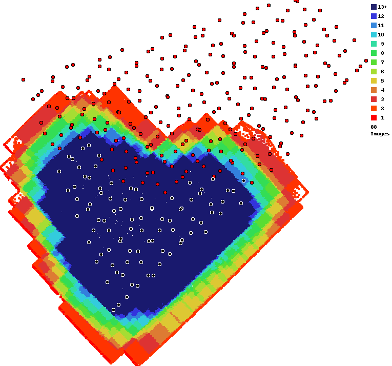
That link goes to a description of what the overlap report is:
https://support.dronesmadeeasy.com/hc/en-us/articles/207148006-Overlap-Reports
In there is says:
"A red dot at an imaging location denotes that there was an image that was processed but it did not have sufficient overlap and/or matchable features so it was not included in the output."
This means that we got and processed all of the images you uploaded but were unable to include them due to feature matching issues.
Where you stood doesn't have anything to do with it since the data was all collected without gaps.
It looks like the issue here is that you had a pretty decent sunspot in your imagery. All of your imagery was taken at exactly solar noon which put a bright spot in each of your images. This moving bright spot constitutes "motion" as far as the feature matching algorithm is concerned. It can't match things that don't look the same between looks at it. This is covered in the Data Collection guidelines that are agreed to at the time of upload.
We will grant a one-time 50% refund for sunspot related issues. Please be sure to collect your data at least 1.5-2 hours before or after solar noon for your area.
There really isn't much reason to run a full grid here. 80/80 overlap in a normal grid would usually be plenty for this type of scene. It might be worth uploading half of the data to see if it turns out better. Sometimes too much data that is conflicting is worse than less data.